ADVERT
World3 min(s) read
Published 15:38 17 Jul 2026 GMT
A tsunami warning has been issued after a magnitude 7.3 earthquake was recorded near the coast of Chiapas, Mexico, according to the United States Geological Survey (USGS).
The earthquake hit Puerto Madero, a major Pacific port and fishing town which is just 13km from the Guatemalan border.
The USGS said that the natural disaster was at a depth of 10 km (6.21 miles), as per Sky News.
While the quake was first recorded as having a magnitude of 7.4, it would later be revised down to 7.3.
Tremors like this can cause destructive secondary hazards, such as landslides and tsunamis, while shallower earthquakes usually cause more intense and concentrated damage and shaking.
Tsunami threats exist for parts of the Pacific which are nearer to the earthquake, according to USGS.
They add that "hazardous tsunami waves" are a possibility for coasts located within 300km of the epicentre of the earthquake which affected the Mexican town.
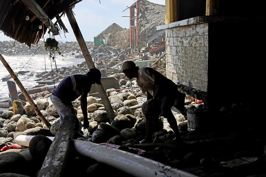
It's been reported that aftershocks have hit the region after the initial earthquake struck the coast.
According to Mexico's national seismological service, smaller quakes have hit the region, with preliminary magnitudes of 5.2, 4.5 and 6.1 being recorded.
It's also been revealed that the earthquake shook buildings and resulted in residents rushing from their homes into the streets of Guatemala City, the country's capital.
Local media revealed videos of staff evacuating a government building, as per security protocols in preparation for the natural disaster.
This tremor was also felt as far as El Salvador, according to witnesses.
It's believed that tsunami waves reaching between 0.3m and 1m above tide level are possible for areas of Guatemala and Mexico, says the US Tsunami Warning System.
Waves are set to be less than 0.3m above tide level along the coasts of other nearby countries, such as Colombia, Costa Rica, and Ecuador, in addition to El Salvador, Honduras, Nicaragua, Panama, and Peru.
Salomon Jara, the governor of the southern Mexican state of Oaxaca, took to social media, saying that no serious damage was immediately reported.
He said that the earthquake was also felt with "moderate intensity" in the state's capital.
While the numbers he reported were different to that of other news outlets, he has sent a message out to citizens in the area.
He wrote, translated from Spanish: "A preliminary magnitude 6.8 earthquake has been recorded with its epicenter in Chiapas; it was felt in Oaxaca.
"The seismic event was felt with moderate intensity. Immediately, Civil Protection agencies activated review and monitoring protocols in the various regions to verify possible impacts and safeguard the population.
"To date, no significant damage has been reported. Citizens are urged to remain calm, follow the authorities' recommendations, and stay informed solely through official channels."
us0 min(s) read
Published 07:35 22 Jul 2020 GMT
world3 min(s) read
world3 min(s) read
world2 min(s) read
Published 11:49 20 Mar 2021 GMT
uncategorised3 min(s) read
Published 14:39 23 Jan 2018 GMT
A tsunami warning has been issued for much of the southern coast of Alaska and the Alaskan Peninsula following a huge 7.8 magnitude earthquake late Tuesday night local time (July 21).
The earthquake was recorded 75 miles off the town of Chignik at a depth of eight miles, the GFZ German Research Center for Geosciences added.
[[twitterwidget||https://twitter.com/NWS_NTWC/status/1285822164013207552]]
The US National Tsunami Warning Center - which issues tsunami information for the continental United States and Canada - issued the following live event map just moments ago (Wednesday, July 22):
[[twitterwidget||https://twitter.com/NWS_NTWC/status/1285837303726788608]]
Per Fox News, locals of coastal cities along the state have reported hearing sirens - such as the Twitter user below who shared dramatic video footage from Kodiak, Alaska.
[[twitterwidget||https://twitter.com/Tyler82092707/status/1285826396325949441]]
The Mirror reports that an alert said the level of tsunami danger is also being evaluated for other US and Canadian Pacific coasts in North America.
The warning from the official tsunami.gov website reads:
"Tsunami Warning in Effect for:
- SOUTH ALASKA AND THE ALASKA PENINSULA, Pacific coasts from Kennedy Entrance, Alaska (40 miles SW of Homer) to Unimak Pass, Alaska (80 miles NE of Unalaska).
- ALEUTIAN ISLANDS, Unimak Pass, Alaska (80 miles NE of Unalaska) to Samalga Pass, Alaska (30 miles SW of Nikolski).
Tsunami Advisory in Effect for:
- SOUTH ALASKA AND THE ALASKA PENINSULA, Pacific coasts from Cape Suckling, Alaska (75 miles SE of Cordova) to Kennedy Entrance, Alaska (40 miles SW of Homer).
- ALEUTIAN ISLANDS, Samalga Pass, Alaska (30 miles SW of Nikolski) to Amchitka Pass, Alaska (125 miles W of Adak) including the Pribilof Islands."
Other areas at risk are still being evaluated.
[[twitterwidget||https://twitter.com/adndotcom/status/1285844696116260864]]
The warning continues:
"Based on the preliminary earthquake parameters, hazardous tsunami waves are possible for coasts located within 300km of the earthquake epicenter."
The alert read: "If you are in a tsunami warning area, evacuate inland or to higher ground above and beyond designated tsunami hazard zones or move to an upper floor of a multi-story building depending on your situation.
"Move out of the water, off the beach, and away from harbors, marinas, breakwaters, bays, and inlets.
"Be alert to and follow instructions from your local emergency officials because they may have more detailed of specific information for your location."
Other locals are now taking to social media to share footage of the evacuation sirens.
[[twitterwidget||https://twitter.com/TheCoastiemater/status/1285839544558870528]]
[[twitterwidget||https://twitter.com/_drfreeze/status/1285835783631302657]]
[[twitterwidget||https://twitter.com/RobMayeda/status/1285822910834212864]]
It is still unknown if the huge earthquake has caused any injuries or damage.
If the earthquake is not downgraded, it will be one of the strongest reported for 2020.
Stay safe.
Published 08:55 30 Jul 2025 GMT
As a tsunami threatens countries along the Pacific coast, here are all the areas that could potentially be at risk.
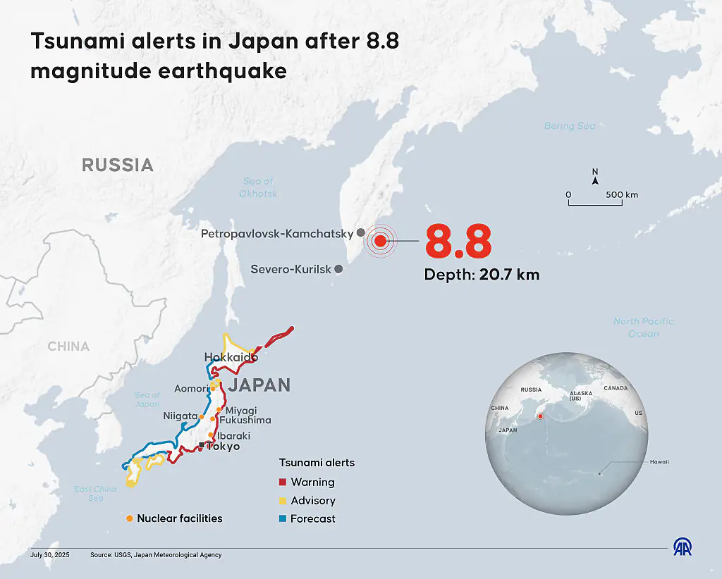
The 8.8 magnitude quake struck near Petropavlovsk, Russia, at 11:25AM local time on Wednesday (30 July), unleashing a powerful shockwave that’s reverberating through coastal regions across multiple continents, per the Independent.
The impact was immediately felt on the Kamchatka Peninsula, where waves of up to 13 feet (4 meters) battered the coast, damaging buildings and flooding streets, according to regional governor Vladimir Solodov.
"Today's earthquake was serious and the strongest in decades of tremors," he said.
Experts are calling this event one of the most powerful quakes in modern history — drawing comparisons to the 2011 Japan earthquake, which reached a magnitude of 9.0 and resulted in a devastating tsunami.
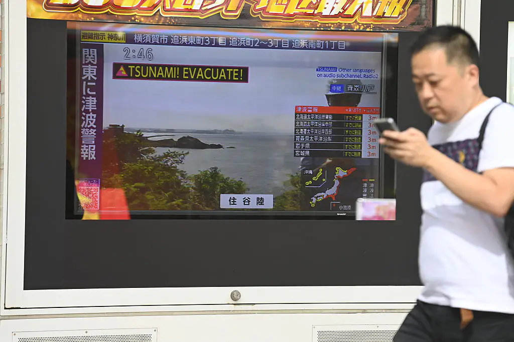
As fears mount over the tsunami’s reach, countries along the Pacific Rim have issued evacuation orders, advising residents to move to higher ground and stay away from coastal areas.
Among the nations under threat are Japan, China, Indonesia, the Philippines, Chile, Mexico, New Zealand, and Peru — all warned to prepare for a worst-case scenario, per CNN.
Even parts of the United States, including California, Alaska, and Hawaii, are on high alert. The U.S. Tsunami Warning System issued statements urging residents in affected regions to take the situation seriously.
Former President Donald Trump also addressed the nation on social media, stating: "Due to a massive earthquake that occurred in the Pacific Ocean, a Tsunami Warning is in effect for those living in Hawaii.
"A Tsunami Watch is in effect for Alaska and the Pacific Coast of the United States. Japan is also in the way. Please visit tsunami.gov for the latest information. STAY STRONG AND STAY SAFE!"
The National Weather Service echoed Trump’s concern, particularly for those in Hawaii. “A series of powerful waves and strong currents may impact coasts around you,” the service said in a statement.
“You are in danger. Get away from coastal waters. Move to high ground or inland now. Keep away from the coast until local officials say it is safe to return.”
So far, the most significant wave heights have varied widely depending on location. In Hawaii, a wave measuring over 5 feet (1.52 meters) was recorded at Kahulu on Maui’s north-central shore.
In Japan, the northern coast has seen 40cm surges, with 60cm waves reported in Hamanaka and the Kuji port in Iwate. Alaska has also recorded moderate activity, with waves below 30 centimeters observed in Amchitka and Adak.
A tsunami advisory has also been issued for parts of California. The National Weather Service’s Los Angeles office posted on X: “A TSUNAMI WATCH IS NOW IN EFFECT for coastal San Luis Obispo, Santa Barbara, Ventura, and Los Angeles Counties. An earthquake 8.7 80 miles southeast of Petropavlovsk Kamchatka, Russia. Stay tuned for updates.”
Published 11:46 20 Apr 2026 GMT
Japan has been thrown into a national emergency after a powerful 7.5 magnitude earthquake struck off the country’s eastern coast, triggering urgent tsunami warnings. The quake hit at around 5PM local time near the Sanriku coast, with Japan’s meteorological agency confirming it occurred at a depth of roughly 10km and about 100km offshore.
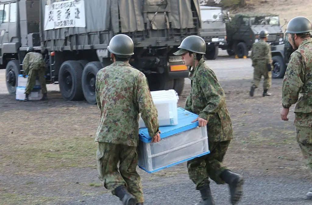
Authorities quickly issued evacuation alerts for coastal regions, with residents in 11 towns in Iwate prefecture told to leave immediately. Prime Minister Sanae Takichi confirmed a task force has been established to respond to the developing situation and repeated calls for people in high-risk areas to move to safety.
Warnings have continued to escalate in the hours since the quake, as officials assess the possible damage from incoming waves. The Japan Meteorological Agency has urged people to stay away from coastlines and rivers and seek higher ground as a precaution.
Oceanography expert Dr Simon Boxal shared insight into what could unfold, telling Sky News: "You'd expect the main waves to be hitting, probably, given the water depth, about an hour later. So, we'd expect those waves to be hitting pretty soon."
He added: "This has the potential to create a moderate tsunami. When I say 'moderate', you've got to put this into perspective with the huge tsunami back in 2011, which killed over 20,000 people.
"That created waves that were over 10 meters high, which basically breached all of the tsunami defence systems that Japan has very effectively put across their coastline.
"We're now looking at waves of between 30cm and 80cm. That still could cause some damage. Ships have left the ports, because once you get away from the shore you're safe.
"We'll wait to see if we get any bigger waves. There's talk of waves up to three metres and that will cause some destruction, particularly in these low-lying areas.
"This is an important area for tourism as well, you've got a lot of people along that coastline."
Reports from NHK confirm evacuations are underway, while data cited by The Independent suggests waves as high as 80cm have already been detected, with the possibility they could grow stronger.
The regions expected to be hit hardest include the central Pacific coast of Hokkaido, the Aomori prefecture coastline, and Iwate prefecture. Officials have also issued warnings about possible landslides and further seismic activity in the coming days, according to the BBC.
Takichi has confirmed that "human and material damage" has already been reported, while tremors strong enough to affect high-rise buildings have been felt in the worst-hit areas.
Japan’s location along the ‘Ring of Fire’ makes it one of the most earthquake-prone nations on Earth. The country has previously faced severe destruction, most notably in 2011 when a 9-magnitude quake triggered tsunami waves reaching up to 40 meters.
That disaster left nearly 20,000 people dead or missing and remains the most severe earthquake event in Japan’s history. Current warnings are being measured against that benchmark as authorities monitor whether the situation could escalate further.
As reported by The Independent, the earthquake struck off the coast of the Miyagi prefecture (located 220 miles north of Tokyo on the east coast of Honshu island) at 06:26PM local time, or 09:26AM GMT.
The Japan Meteorological Agency later confirmed that the quake had a magnitude of 7.2 at a depth of 60km.
In response, Japan public broadcaster NHK has issued a warning to residents that a one-meter-high tsunami could be expected to hit the Miyagi Prefecture, the Mirror reports.
Fortunately, there are currently no reports of damage or injuries.
The warning reportedly stated: "It is dangerous in the sea or near the coast. Those who are in the sea should immediately get out of the sea and leave the coast."
Per Sky News, local shop worker Shizue Onodera told NHK: "It was a really bad, long shaking from side-to-side. It was even longer than the quake last month, but at least the building here is all right.
"Lots of bottles smashed on the floor," she added.
The earthquake could also reportedly be felt in Tokyo - approximately 400km south of the epicenter.
The quake comes 10 years after the Miyagi prefecture was heavily damaged by an earthquake and tsunami in 2011.
Thankfully, Tokyo Electric Power has reported that it has found no irregularities at its Fukushima Daiichi nuclear plant - which had been severely damaged by the March 2011 quake. Additionally, a spokesperson also confirmed that there were no irregularities at the nearby Daini facility as well.
And the nuclear regulator confirmed no irregularities at Tohoku Electric Power Co’s Onagawa nuclear plant.
The devastating 2011 seismic event a decade ago resulted in caused nuclear meltdowns and mass evacuations.
The 2011 disaster also resulted in 20,000 deaths.